


ROAM THE UNKNOWN ON YOUR NEXT EXPEDITION
This rugged all-terrain navigator will show you the way, with navigation that guides you through even the most remote areas less traveled.
ULTRABRIGHT, GLOVE-FRIENDLY 8-INCH DISPLAY
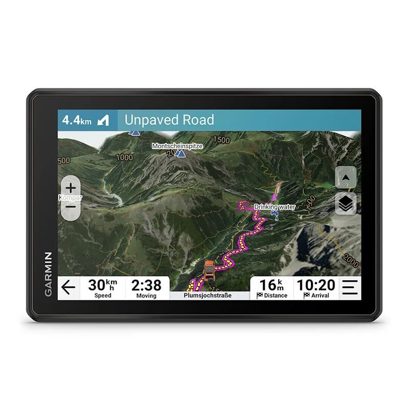
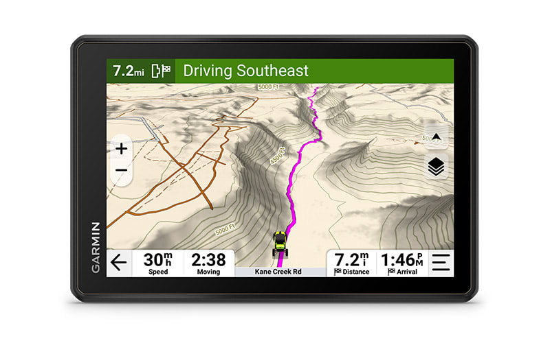
TURN-BY-TURN TRAIL NAVIGATION WITH TOPOGRAPHIC MAPS FOR NORTH AND SOUTH AMERICA
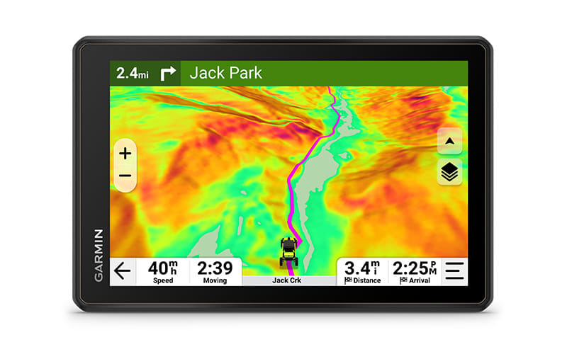
SEE HIGH-DEFINITION ELEVATION MAPS, LAND BOUNDARIES AND MORE
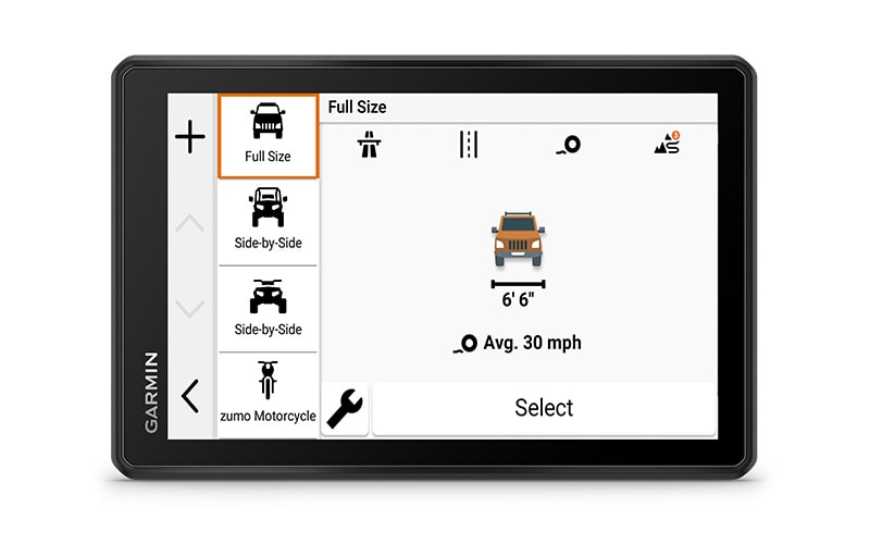
CUSTOM STREET ROUTING FOR THE SIZE AND WEIGHT OF YOUR RIG1
SATELLITE IMAGERY SHOWS VIVID OVERHEAD VIEWS OF YOUR ROUTE
SUPPORTS OUTDOOR MAPS+ FOR PREMIUM MAPPING (SUBSCRIPTION REQUIRED)
WHAT YOU'LL LOVE
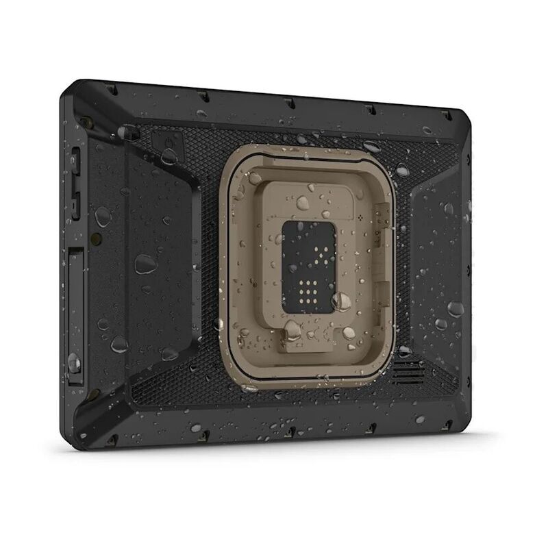
RUGGED DESIGN
The 8-inch high-resolution, ultrabright and glove-friendly touchscreen navigator is purpose-built to withstand extreme temperatures and weather (IP67 dust/water rating) for rugged off-road adventures. The heavy-duty mounting hardware withstands high vibration and shock. Plus, the upgraded processor delivers faster performance, including map drawing and route calculations.
TURN-BY-TURN NAVIGATION
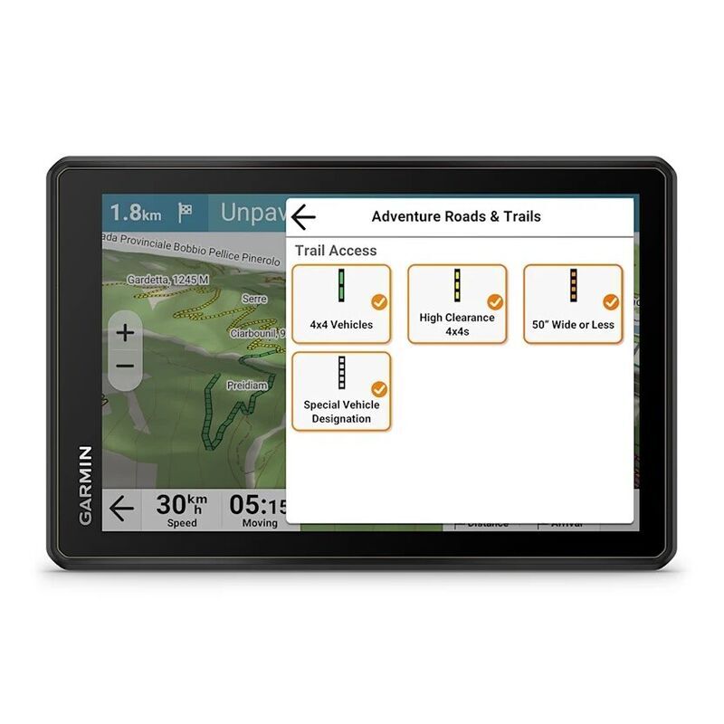
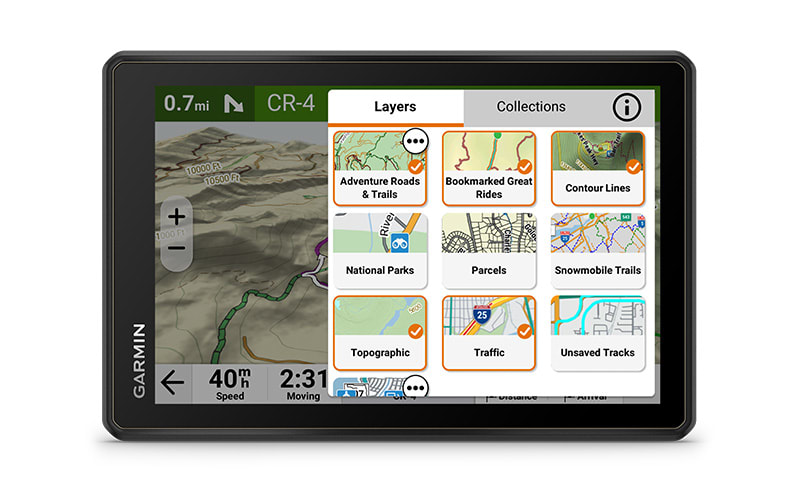
Get turn-by-turn trail navigation for unpaved roads and trails in off-road riding areas with OpenStreetMap™, U.S. Forest Service Motor Vehicle Use Maps, and Adventure Roads and Trails map content2. In North America, view off-road riding areas with trail difficulty ratings.
SATELLITE VIEWS
Download subscription-free satellite imagery directly to the device via Wi-Fi® technology to see high-resolution overhead views of routes and terrain.
CUSTOM ROUTING
Get City Navigator® maps of North America with custom street routing for the size and weight of your rig1. Plus, receive alerts for potential hazards along your route, including sharp curves, speed changes and more.
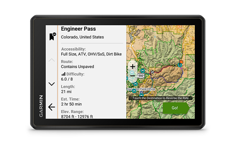
GREAT RIDES
Find great rides for off-road; discover the best places to explore, bookmark them to sync with your navigator, rate difficulty, and upload pics (requires use of the Tread® smartphone app).
OUTDOOR MAPS+
Purchase an Outdoor Maps+ subscription for ongoing access to a wide variety of premium mapping content, including burn zones, night lights and more.

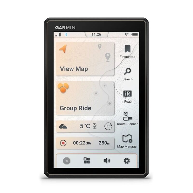
FIND NEW WAYS TO EXPLORE
NAVIGATION FEATURES
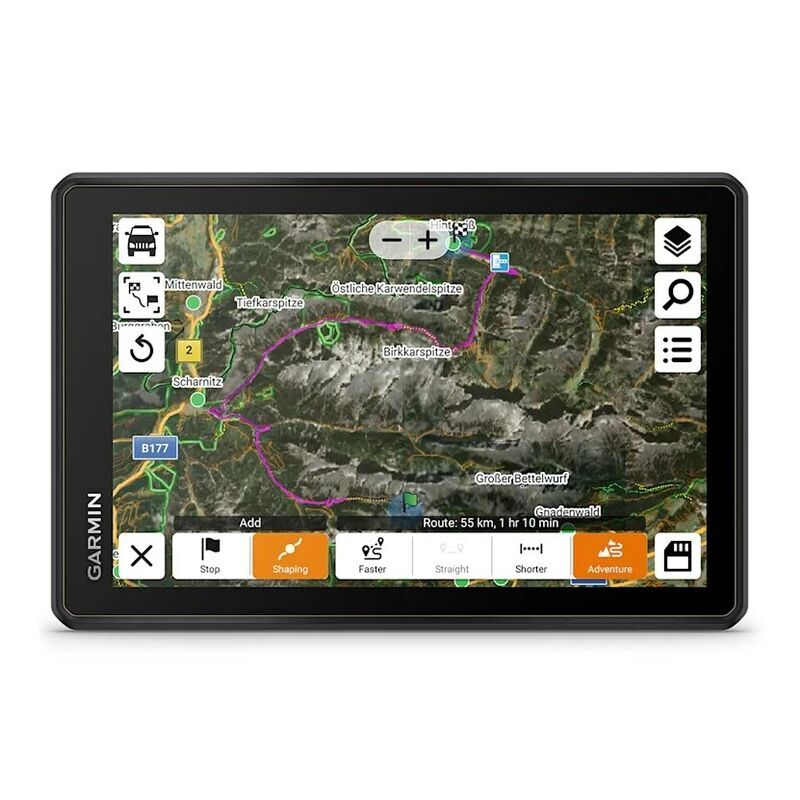
EASY ROUTE PLANNER
Use the Tread smartphone app to easily plan routes with the same maps, vehicle profiles and route preferences that you have on the Tread device. Import and export GPX files to share your favorite routes with your fellow riders.
CAMPGROUNDS
The Tread 2 navigator comes with a preloaded directory of Ultimate Public Campgrounds to help you find more than 46,000 camping locations across the U.S.
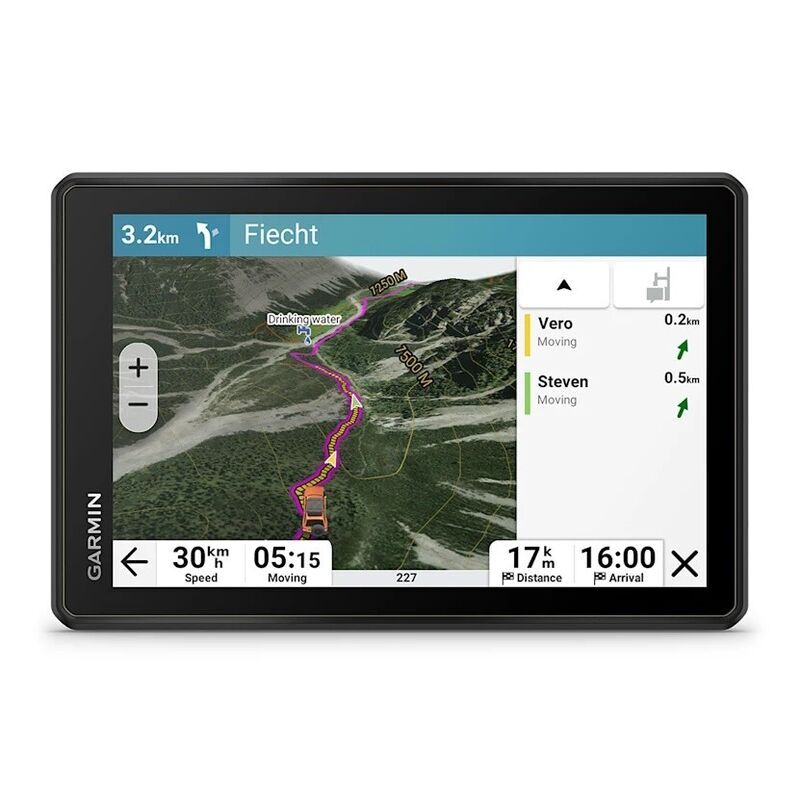
GROUP RIDE MOBILE
Track friends from your compatible smartphone or Tread device when you and your friends use the Tread app’s group ride mobile feature.
SYNC YOUR DEVICES
Use the Tread mobile app to easily sync waypoints, tracks, routes and collections across your mobile device and Tread 2 navigator.
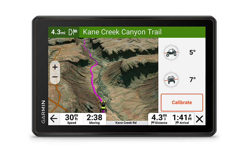
ELEVATION MAPS AND MORE
Venture on- and off-road with high-definition digital elevation maps. Explore dirt and snow trails, or follow City Navigator maps for street routes2.
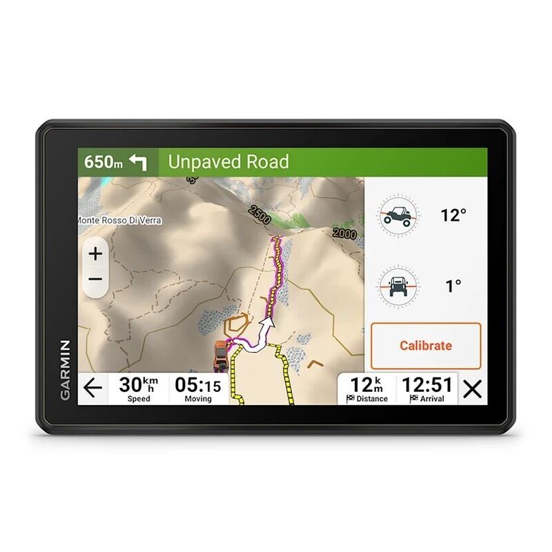
ABC SENSORS
For tough-terrain guidance, built-in sensors include an altimeter, barometer and compass.
KNOW YOUR BOUNDARIES
Access public land boundaries for national forests, Bureau of Land Management, wilderness areas and more. Also, see private land boundaries and landowner information for parcels greater than 4 acres.
LIVE WEATHER
Weather ahead? Pair Tread 2 with your compatible smartphone, and download the Tread app to access live weather, storm alerts, animated radar and more.
TRAVELING MUSIC
A built-in media player lets you easily control music loaded on your compatible smartphone on the navigator’s display — and hear your tunes through your helmet or headset enabled with BLUETOOTH® technology.